http://pearl.ias.unt.edu:9876/
| http://pearl.ias.unt.edu:9876/ |
|
| Objective:
Increase awareness of NASA technologies for disaster reduction. Approach: An Internet WWW site has been established that allows people to find out more about natural and technological hazards, and learn how to use satellite remote sensing for disaster planning, response and mitigation. Accomplishments:
| This satellite image shows the Mississippi
River flood in Saint Louis during 1993 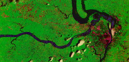 Significance:
|